
Our plan from the time we left Virginia in December of 2023 was to spend two or three months in the Bahamas, then work our way south to be in Grenada by hurricane season. The fact that we left late from Virginia put us a little behind schedule. Keeping a schedule while sailing is not a good idea anyway.
So we were in Georgoetown, Bahamas looking to make the jump to the Caribbean. This involved going against the trade winds for hundreds of miles
Sailing against the trade winds to get to the Virgin Islands is not something to take lightly. When presented with what option we were going to take to get from the Bahamas to the Virgin Islands the voice in the back of my mind said “don’t beat into it all the way to the Virgins.” That route, the one where you’re beating into it from the Bahamas to the Dominican Republic, Puerto Rico, and ultimately to the Spanish Virgins before reashing the USVI is called the Thorny Path for a very good reason.
The trade winds are relentless, having sailed up and down the Caribbean island chain I am intimately familiar with trade wind sailing. It’s 15 knots and 3 foot seas at its best, and 25 knots and 10 foot seas at its worst. Beating straight into that type of wind and seas is not my idea of a good time. Neither is it good for the boat or crew morale, both of which need to be taken into consideration.
The other main option to get from the Bahamas or even from the southern US East Coast to the Virgin Islands is called the I65 Route. The name comes from the longitudinal line that is your easting target before heading south. Once you get to the 65th longitude, or I would recommend even a little further east if possible, you will have a beam reach heading south to either the BVI or USVI.
The general goal is to head east during a period where a frontal system is moving from the US East Coast that forces the trade winds to abate. The further north you go the easier this is because true trade winds don’t normally extend north of the Bahamas.

Departure
Where you depart from is going to affect how you approach the passage. Departing from the Carolinas or even northern Florida or northern Bahamas is preferable to the southern Bahamas. We left from Georgetown in the Exumas, and I probably would try to be more north in the Bahamas if we ever had to do it again, either leaving from Eleuthera or even the Abacos.
Leaving from the Bahamas your sail is going to be roughly 1000 miles, obviously more from the US east coast.
Easting
Once you depart your goal is to go due east, or if you are in the southern Bahamas east north east. You are going to continue that easting for hundreds of miles. What I did was place a mark on our chartplotter at a point I thought we could make it to just east of 65 and a little north of the general lattitude of Georgetown. That was the general area we were heading to. In the photo below you can see our actual track based on gps positions we marked along our journey.

Motoring
Realize that much, or even most, of your easting is going to be motoring or motor-sailing. We had two days of zero wind and some of the other days we had to motor sail because of not much wind. You want to leave with full tanks and perhaps some jerry jugs depending on your tankage and range. Once you hit 65 though you should have good wind on the beam and you can turn your motor off.
Weather Routing
As noted above, you are looking for a window of low or no wind to make your easting to the 65th longitude. If this involves motoring for five or six days that’s fine, you are not going to get a beam reach for the easting portion of your passage. What we waited for was a frontal system coming from the north that pushed the tradewinds back, we started with light close hauled sailing for a couple of days, then the wind died for a couple of days, after the front came through we had 20+ knots aft of the beam for most of the rest of the passage. The wind over a period of a couple of days nearing the end of our passage veered from the NW all the way from the East, so we kept the same sail configuration and angle for more than 48 hours.
I would probably prefer a window of zero wind, but these windows only present themselves a couple of times a month at most, so you have to take what you can get. The other challenge is that reliable weather forecasting is only about five days out. This is a seven to nine day passage or longer depending on your departure location and boat speed. We made it in eight days. But when choosing a window you have to assume the trade winds will fill back in at 15 – 20 knots from the east.
Bailing Out
Because weather routing has roughly a five-day outlook there is a chance the trade winds may fill in before you hit the 65th longitude, this is obviously a problem. We were prepared to turn south prior to hitting 65 and head to Puerto Rico or even the Dominican Republic if needed. Luckily we made it just past 65 before the wind started clocking around, but this does need to be a consideration.
Go Past 65
I highly recommend going past longitude 65, maybe even a full degree. If the trade winds come from due east, or even ENE, you are fine, but if they veer to the south east, you are going to wish you went past 65 to have a better angle. Whatever you do, and I heard this from lots of sailors prior to this passage is absolutely do not turn south before you hit 65. Do not try to cut the corner. I completely agree with this sentiment.

Conclusion
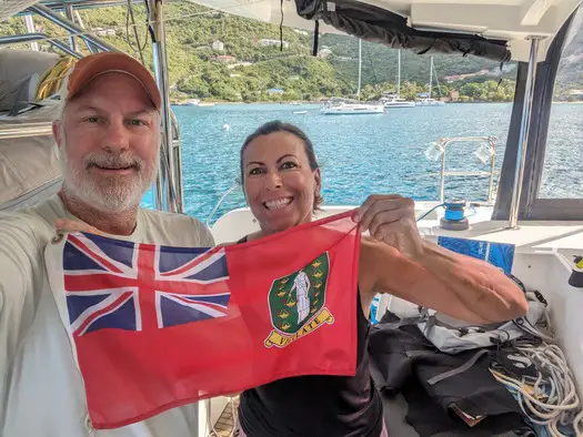
Now that we’ve arrived in the Virgin Islands, actually I’m in St. Martin as I write this, having talked to many sailors that went through the thorny path, I’m pretty happy we did the I65 route. If I had to do it over again, I would sail the same route given a good weather window.
I would have gone further north if I could have, or even east to San Salvador to cut off a day of the passage, but overall it was better than going the thorny path route.