
Most of the Caribbean basin is blessed and cursed with the east to west trade winds blowing year round. It is a blessing if you are sailing any direction but east. However, if you need to go east you will be bashing into wind and waves.
There are many Caribbean sailing routes, this article will cover most of the popular ones cruisers use to move about the Caribbean’s most travelled areas.

The Lesser Antilles
The Windward Islands generally include all of the islands from Trinidad & Tobago in the southern Caribbean to the US Virgin Islands to the north. In either direction this is pretty easy sailing.
Many boats arrive in the vicinity of Grenada or St. Lucia after crossing the Atlantic in late fall or early winter in the northern hemisphere. The trades dominate from the east and are consistent. So you can sail up and down the chain of islands on a beam reach nearly the entire time.
Even better is that these islands are fairly evenly spaced out so a day sail will get you to the next island. Many sailors spend a week or two at each island before moving on.
This is my favorite part of the Caribbean due to the beauty of the islands, easy sailing, and the richness of diversity.
The Greater Antilles
The Greater Antilles incorporate the islands from Puerto Rico in the east, down to the Cayman Islands in the southwest, Jamaica, Cuba and Hispaniola. Since they lie mostly east to west they present more of a problem than the Lesser Antilles.
Going downwind from the east to the west is simple, but coming the other way against the wind requires some strategy and planning that some other routes do not.
I highly recommend A Gentleman’s Guide to Passages South by Bruce van Sant. The entire book is devoted to sailing this part of the world.
Fun Fact: The Greater and Lesser Antilles are named after the island of Antillia. Antilla happens to be a fictional island that doesn’t exist. I guess some European explorer kept looking for it and separated the groups into the Greater and Lesser Antilles. The names stuck, but to this day there is no Antillia.

Bahamas
The Bahamas are technically not in the Caribbean. They are in the Atlantic Ocean.
However, when people refer to the Caribbean they are generally including the Bahamas and Turks & Caicos. So, for the point of this blog, we will be including them.
There are generally two routes through the Bahamas, going to windward to the southeast, many boats are travelling from Florida towards the southern Caribbean through the Bahamas. The other route is going from the Caribbean through the Bahamas to the US East Coast.
Some of the Bahamas are in the trade wind belt, but they are also affected by fronts coming off the coast of Florida, so you are not completely going to windward all the time if you are travelling towards the Caribbean. You can wait for weather windows and pick your way through the Bahamas and Turks & Caicos. You will find great day sails and beautiful anchorages the entire way down the island chain.
I 65 Sailing Route
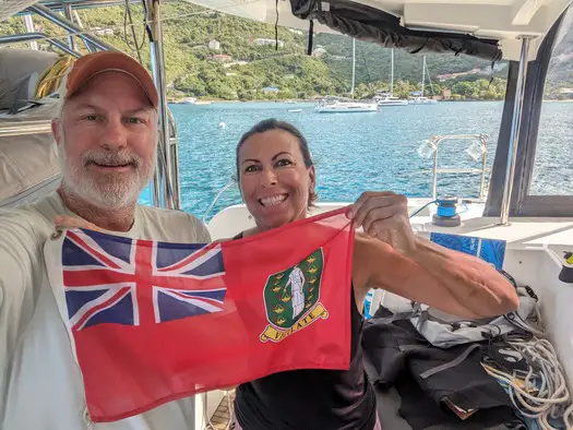
If you are pressed for time and want to go from the Bahamas to the British Virgin Islands, or just want to skip the thorny path to windward you can take what is referred to as I 65. We just completed this route about a month ago.
Leaving the Bahamas you sail to the east north east until you hit 65 or 66 degrees longitude. Then you start your run south to Tortola hopefully on a beam reach. This is shown on most guides as one tack, but you will be playing wind angles to your favor to make it to your turning point.
The first part of the route on I 65 is going to be to windward, so try to find a favorable weather window. Bring plenty of fuel, you might wind up motoring a third of the way or more.
To the Panama Canal
There are many routes to the Panama Canal, but the two most common are from Grenada to the ABC Islands, then Columbia and finally to Panama. This first part of this route is pretty easy downwind sailing. The second part of this leg off the coast of Columbia is very windy and can be dangerous.
Log on to your favorite wind app and look at this section of water for a few days. It regularly blows 30+ knots with 10 – 15 foot seas. This area off the coast of Columbia is not to be taken lightly.
The other way you can go is from Florida, the Bahamas, or the northern Caribbean between Cuba and Hispaniola south past Jamaica towards Panama. This is a more benign route, but still needs to be planned carefully.
Hurricane Season
Popular destinations to get out of the hurricane box during hurricane season are Grenada, the ABC islands, Guatemala, and Panama. My insurance requires me to be below 12 degrees, 10 minutes latitude, which is basically the top of Grenada.
If you are not familiar with the hurricane box, it is an imaginary box surrounding the areas of the Caribbean for insurance purposes. Generally speaking for most insurance companies, they want you in Grenada or south, or from Georgia north. Insurance companies want you outside of these areas because mathematically they know there is likely to be more damage caused by hurricanes from July to November.
If you remain in the box they either raise your premium, or you are not covered altogether.
If you intend to stay in the hurricane box probably the absolute best option is Luperon in the Dominican Republic. Luperon is the best hurricane hole in the entire Caribbean. You really need to study your options and have a plan of what you are going to do if you remain in the Caribbean for hurricane season. Another option is to head north to the East Coast of the US. One of our insurance companies required us to be north of Cape Hatteras, so the Chesapeake Bay was a natural place for us to go.